Inhambane
The settlement owes its existence to a deep inlet into which the small Mutamba River flows. Two protective sandy headlands protect the harbor and form a sandbank. The sister town of Maxixe is located across the bay of Inhambane.
Inhambane is one of the oldest settlements on Mozambique's eastern coast. Dhows traded here as early as the 11th century. Muslim and Persian traders were the first outsiders to arrive to the area by sea and traded pearls and ambergris, and they also traded at Chibuene in the south. The area became well known for its local cotton spinning and production by the Tonga tribe. Sometime before the Portuguese reached the area, the Karanga had invaded Inhambane and formed a number of local chieftaincies. They dominated over the Tonga cotton workers gained the rewards of trading with the Muslims.
When Vasco da Gama rounded Africa in the late 15th century, he pulled into Inhambane to replenish stocks and to explore. He took an immediate liking to the area and named it Terra de Boa Gente or 'Land of the Good People'. In 1505, a ship sent by Francisco de Almeida was shipwrecked south of the town, but the Portuguese gained an initial meeting with the Karanga chiefs. Later, their sons landed on Mozambique Island to survey the situation. The Portuguese eventually established a permanent trading post at settlement in 1534. Inhambane was then chosen as the first Jesuit mission to Southeast Africa in 1560. The port gradually grew as an ivory and slave trading centre, particularly in the eighteenth century under mostly Indian control. It was destroyed in 1834 by Soshangane, but grew rapidly in the second half of the century as a town of Portuguese East Africa. The old cathedral and old mosque was built during that period. However, in the 20th century the status of the town declined and the economic situation worsened as Maputo (called Lourenço Marques before 1975) became the main centre.
The 170-year-old Cathedral of our Lady of Conception is located in the old quarter of the city where a rusted ladder leads to the top of the spire, offering panoramic views of the city and harbor. The city is now home to a museum and a market and is known for its nearby beaches of Tofo and Barra. The central market located along the main boulevard called simply "Mercado Central" offers numerous foods, ranging from a colorful array of spices and vegetables to prawns, fishes, and cashew nuts.
Motor and dhow taxis sail from the town to Maxixe. The town of Inhambane has one of the largest working fleets of dhows on the Swahili Coast.
Map - Inhambane
Map
Country - Mozambique
 |
 |
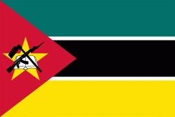
| Flag of Mozambique | |
Notably Northern Mozambique lies within the monsoon trade winds of the Indian Ocean and is frequentely affected by disruptive weather. Between the 7th and 11th centuries, a series of Swahili port towns developed on that area, which contributed to the development of a distinct Swahili culture and dialect. In the late medieval period, these towns were frequented by traders from Somalia, Ethiopia, Egypt, Arabia, Persia, and India.
Currency / Language
| ISO | Currency | Symbol | Significant figures |
|---|---|---|---|
| MZN | Mozambican metical | MT | 2 |
| ISO | Language |
|---|---|
| PT | Portuguese language |


